
Lehigh Codex 12 Anon. Portolan charts
Title
Anon. Portolan chartsOther related names
- Honeyman, Robert B., former owner (http://viaf.org/viaf/78623406)
Funders
- Council on Library and Information Resources
Call number
Lehigh Codex 12(Bethlehem, United States, Lehigh University, Special Collections)
Alternate identifiers
- Hirsh: MS Hirsh 12
Publisher
Special CollectionsLanguage
LatinOrigin
- Place
-
Italy
Summary
Three maritime charts bound in contemporary parchment over paper board. The first chart shows the 26th to the 51st northern gradations, the coasts of England and Ireland south to Madeira and the Canary Islands, including the coasts of Spain and France. The second chart shows the whole of the Mediterranean, including the coasts of the eastern Mediterranean and Northern Africa. The third chart shows the Mediterranean from the Meridian of Gallipoli (Italy) to Dakar, Africa, including part of the Atlantic Ocean and the coasts of Spain and Portugal. All have rhumb lines, and were used for navigation. Although written in Italy, the place names on the manuscript show Portuguese influence.
Notes
- Measurement for page dimension is for the full opening, as the charts are horizontally aligned and span the opening
Extent
295 x 406 mm bound to 297 x 209 mmSupport
ParchmentBinding
Contemporary parchment over paper boardsLayout
Decoration
Illuminated compass roses on each chart; heraldic shield under a crown on Chart 1; blue medallion containing a crescent moon with a face in profile under a crown on Chart 2; land masses are outlined in green (Europe) brown (currently Turkey) and red (currently Syria, Lebanon, Israel, and Africa)
Script
Keywords
- Portolan chart
- 16th century
- Italian
- Chart
- Diagrams
- Drawing
- Heraldry
- Humanistic
- Illumination
- Medallion
- Italy
- Cartography
- Maritime
Licenses
-
- Text
- These images and the content of Special Collections Lehigh Codex 12: Anon. Portolan charts are free of known copyright restrictions and in the public domain. See the Creative Commons Public Domain Mark page for usage details, http://creativecommons.org/publicdomain/mark/1.0/.
- URL
- http://creativecommons.org/publicdomain/mark/1.0/
-
- Text
- To the extent possible under law, Lehigh University Libraries, Special Collections has waived all copyright and related or neighboring rights to this metadata about Special Collections Lehigh Codex 12: Anon. Portolan charts. This work is published from: United States. For a summary of CC0, see https://creativecommons.org/publicdomain/zero/1.0/. Legal code: https://creativecommons.org/publicdomain/zero/1.0/legalcode.
- URL
- https://creativecommons.org/publicdomain/zero/1.0/legalcode
Table of contents
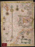
- Chart 1 (full) — Map depicting the southern coast of England, the western coast of France, the Iberian peninsula, and the northern coast of Africa
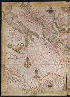
- Chart 2 (full) — Map depicting the Mediterranean Sea from Italy to the Middle East
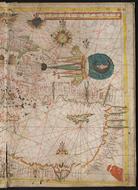
- Chart 2 (left) — Map depicting the eastern half of Chart 2 (including Italy, Greece, Sicily, and the north coast of Africa)
- Chart 2 (right) — Map depicting the western half of Chart 2 (including Turkey, Lebanon, Egypt, and Cyprus)
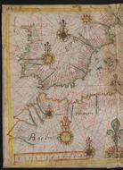
- Chart 3 (full) — Map depicting the Mediterranean Sea (from the Iberian peninsula to Italy)
- Chart 3 (left) — Map depicting the western half of Chart 3 (including the Iberian peninsula and the north coast of Africa)
- Chart 3 (right) — Map depicting the eastern half of Chart 3 (including Italy, Sicily, and the north coast of Africa)
Images
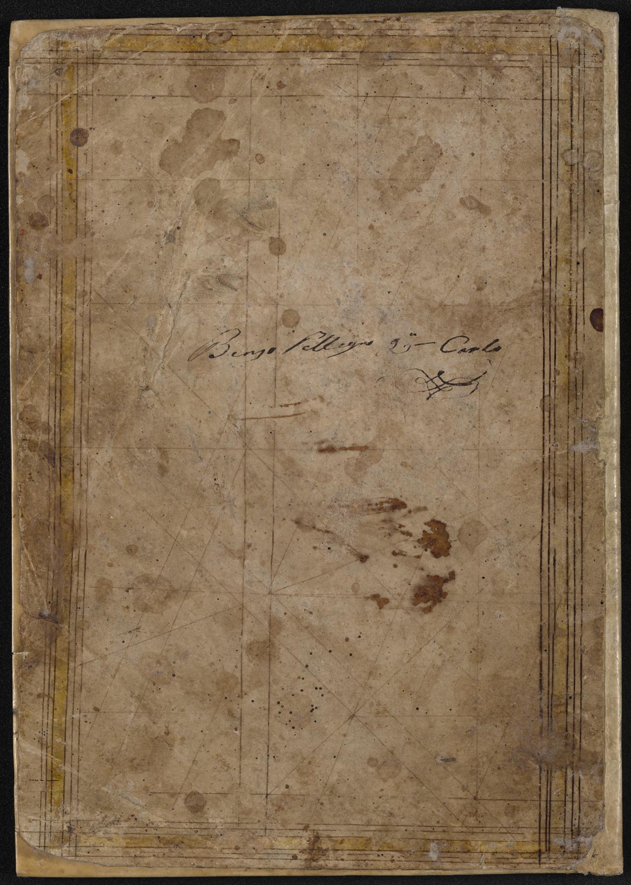
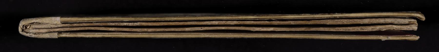
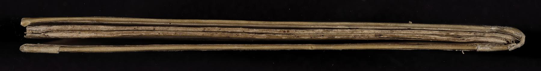
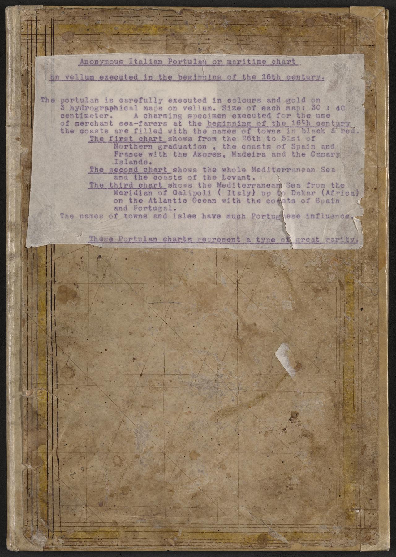 Front cover
9161_0000.tif (103.7 MB)
9161_0000_thumb.jpg (5.4 KB)
9161_0000_web.jpg (344.9 KB)
Decoration: Title label pasted to front cover
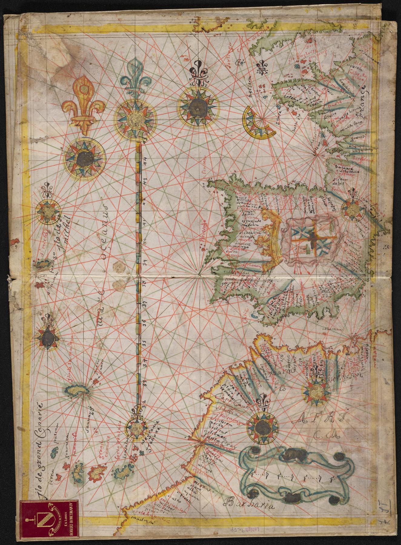 Chart 1 (full)
9161_0001.tif (208.6 MB)
9161_0001_thumb.jpg (7.3 KB)
9161_0001_web.jpg (494.4 KB)
Section: Map depicting the southern coast of England, the western coast of France, the Iberian peninsula, and the northern coast of Africa
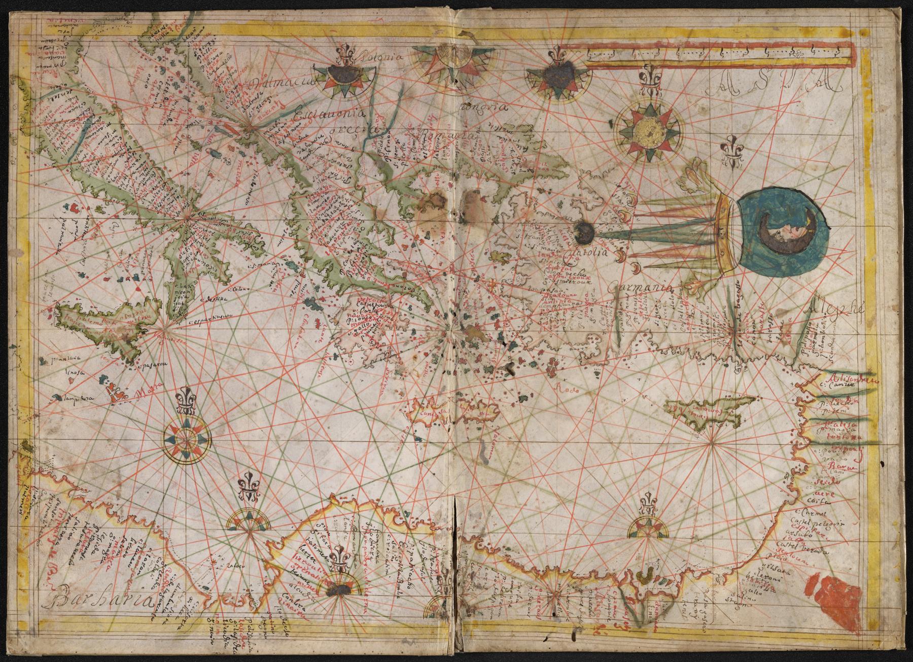 Chart 2 (full)
9161_0002.tif (201.6 MB)
9161_0002_thumb.jpg (7.2 KB)
9161_0002_web.jpg (498.5 KB)
Section: Map depicting the Mediterranean Sea from Italy to the Middle East
 Chart 2 (left)
9161_0003.tif (211.1 MB)
9161_0003_thumb.jpg (7.6 KB)
9161_0003_web.jpg (468.9 KB)
Section: Map depicting the eastern half of Chart 2 (including Italy, Greece, Sicily, and the north coast of Africa)
 Chart 2 (right)
9161_0004.tif (213.3 MB)
9161_0004_thumb.jpg (7.3 KB)
9161_0004_web.jpg (433.2 KB)
Section: Map depicting the western half of Chart 2 (including Turkey, Lebanon, Egypt, and Cyprus)
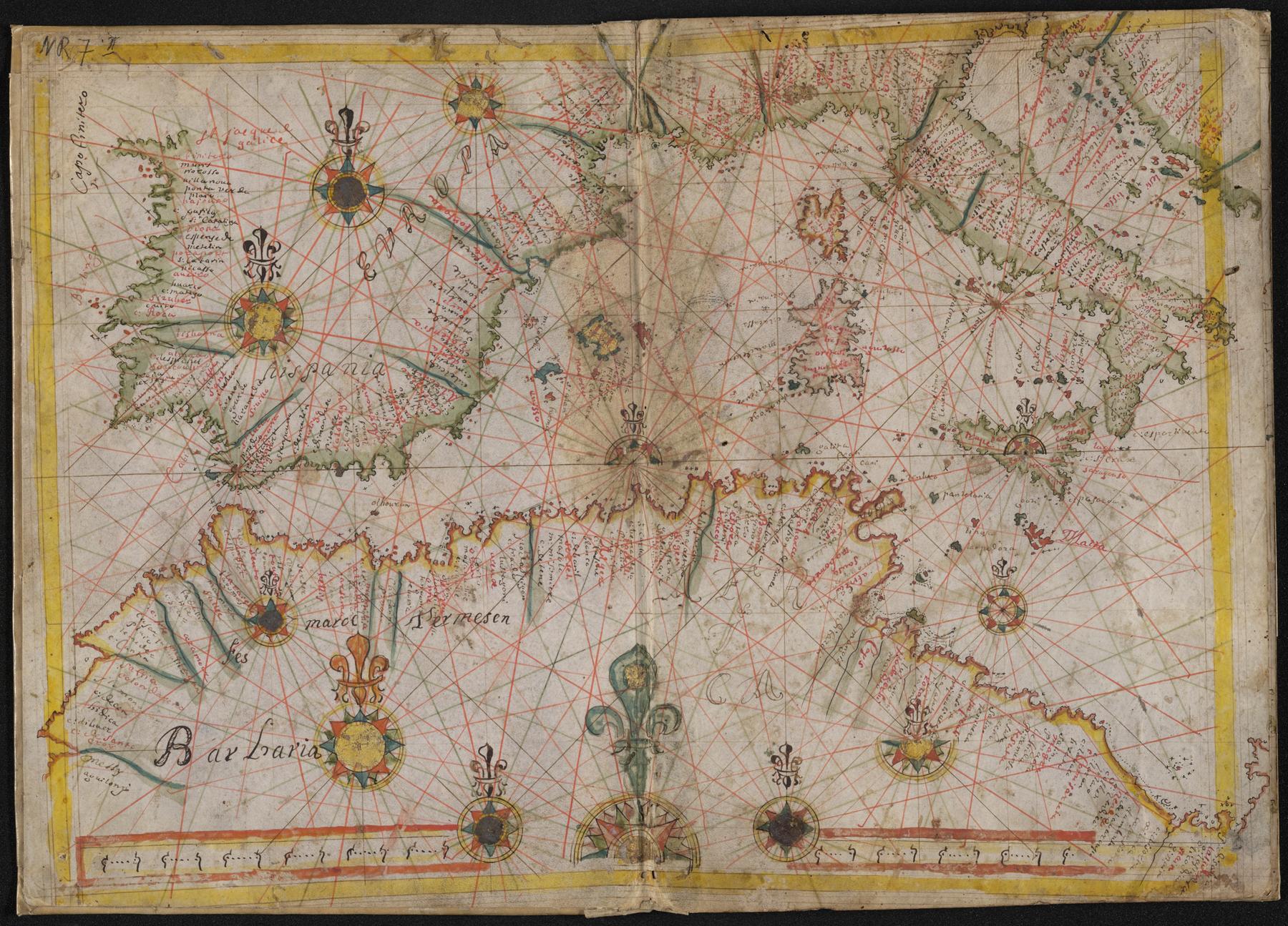 Chart 3 (full)
9161_0005.tif (206.3 MB)
9161_0005_thumb.jpg (6.8 KB)
9161_0005_web.jpg (490.0 KB)
Section: Map depicting the Mediterranean Sea (from the Iberian peninsula to Italy)
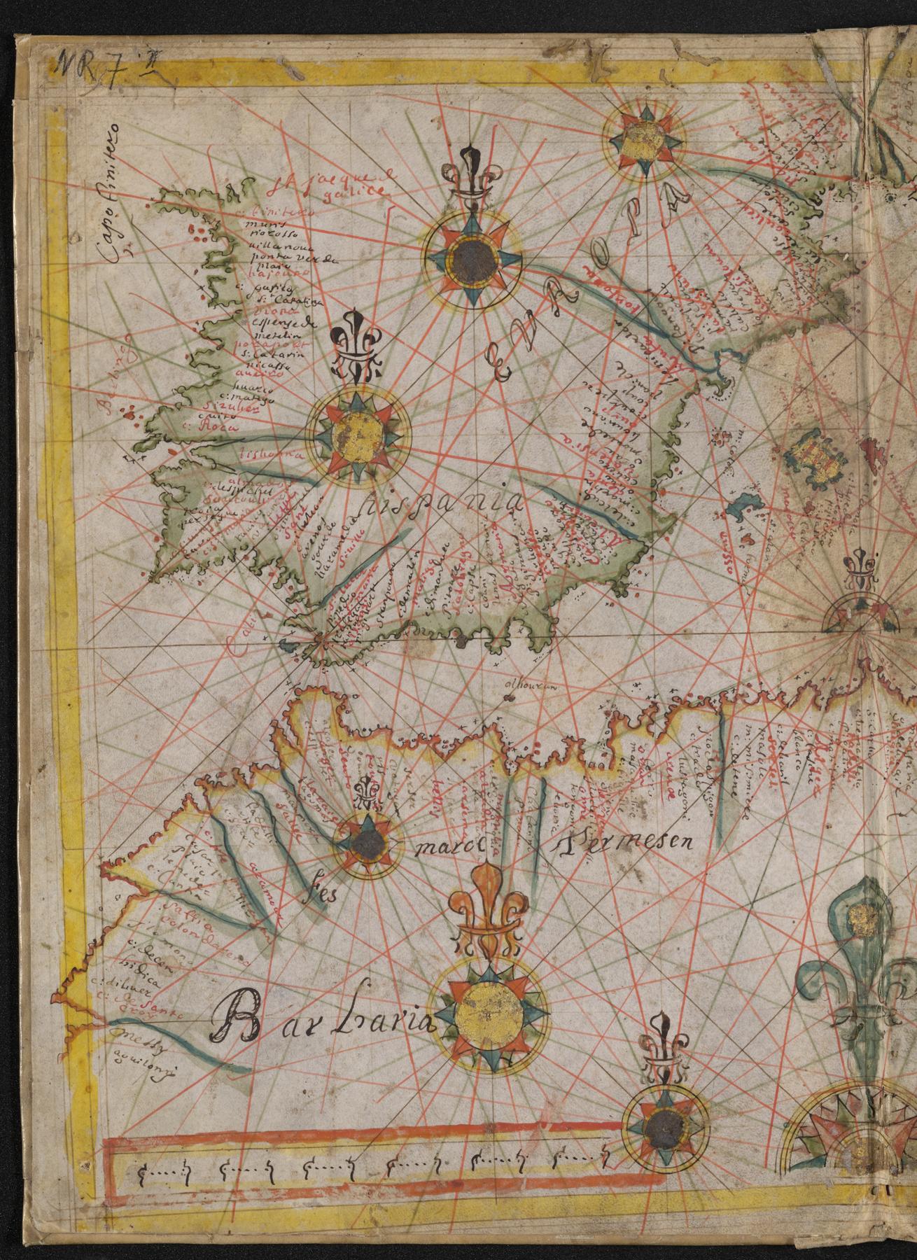 Chart 3 (left)
9161_0006.tif (216.7 MB)
9161_0006_thumb.jpg (7.1 KB)
9161_0006_web.jpg (454.0 KB)
Section: Map depicting the western half of Chart 3 (including the Iberian peninsula and the north coast of Africa)
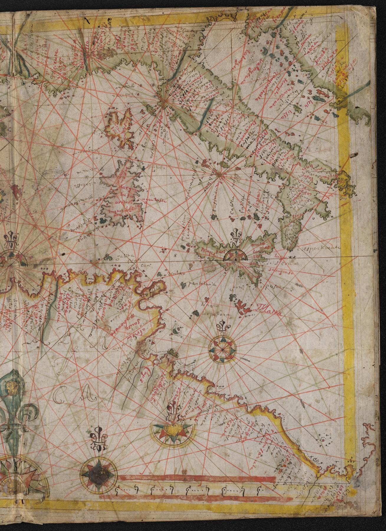 Chart 3 (right)
9161_0007.tif (216.4 MB)
9161_0007_thumb.jpg (6.9 KB)
9161_0007_web.jpg (456.7 KB)
Section: Map depicting the eastern half of Chart 3 (including Italy, Sicily, and the north coast of Africa)