
StGeorge.BurialGroundPlacementofLots Northwest burial ground, placement of lots, 1818, 1875
Title
Northwest burial ground, placement of lots, 1818, 1875Authors
- St. George's Methodist Church (Philadelphia, Pa.)
Funders
- Council on Library and Information Resources
Call number
StGeorge.BurialGroundPlacementofLots(Philadelphia, United States, St. George's United Methodist Church)
Alternate identifiers
Publisher
St. George's United Methodist ChurchLanguage
EnglishOrigin
1818-1875
- Place
-
United States
Summary
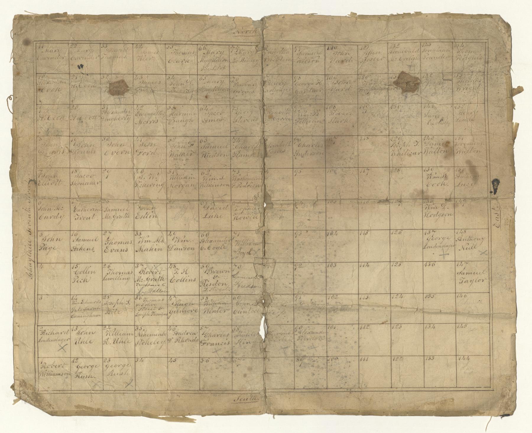
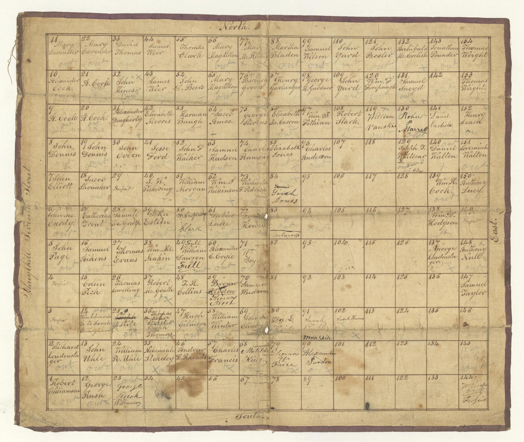
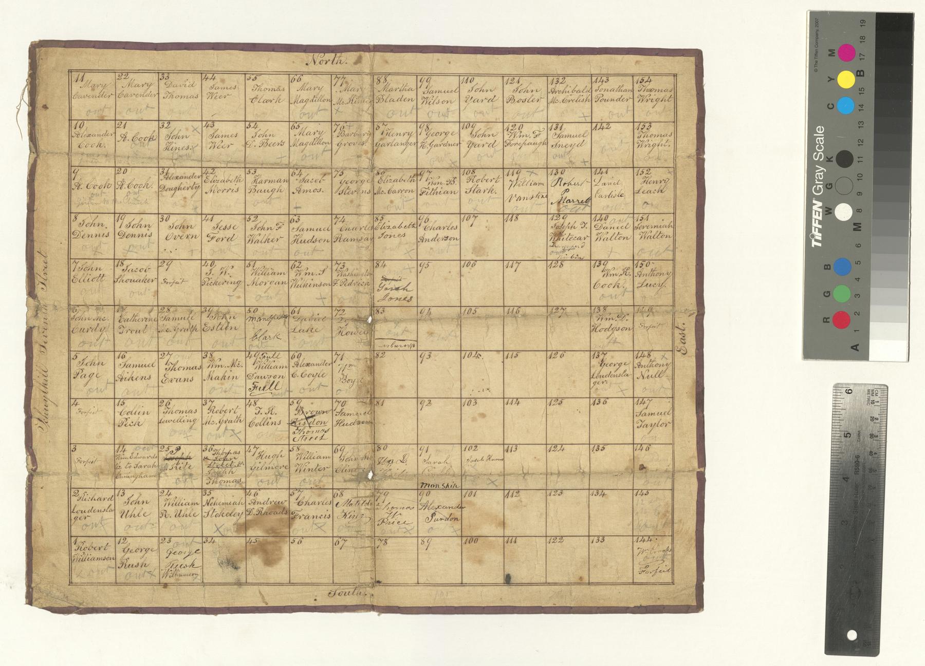
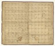
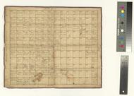
Two maps showing a grid of cemetery lots and numbers, with the names of the persons buried there. The burial ground was located at the southeast corner of what is now 16th St. and Fairmount Ave. Sometime between 1860 and 1875, the burial ground had been sold, the bodies disinterred, and the land developed into housing. The second map has notations of "x" and "out" to indicate that bodies had been moved.
Extent
2 pages;Support
PaperRelated resources
- Philadelphia Congregations Early Records Project (https://philadelphiacongregations.org)
- ATLA Digital Library (https://dl.atla.com/collections/philadelphia-congregations-early-records-project)
Subjects topical
- Burial records
- Church records and registers
- Methodists
- Cemeteries
- Methodist Church
- Pennsylvania--Philadelphia
- St. George's Methodist Church (Philadelphia, Pa.)
Genres
- Manuscripts
- Maps
Keywords
- 19th century
Licenses
-
- Text
- These images and the content of St. George's United Methodist Church StGeorge.BurialGroundPlacementofLots: Northwest burial ground, placement of lots, 1818, 1875 are free of known copyright restrictions and in the public domain. See the Creative Commons Public Domain Mark page for usage details, http://creativecommons.org/publicdomain/mark/1.0/.
- URL
- http://creativecommons.org/publicdomain/mark/1.0/
-
- Text
- To the extent possible under law, Saint George's United Methodist Church of Philadelphia has waived all copyright and related or neighboring rights to this metadata about St. George's United Methodist Church StGeorge.BurialGroundPlacementofLots: Northwest burial ground, placement of lots, 1818, 1875. This work is published from: United States. For a summary of CC0, see https://creativecommons.org/publicdomain/zero/1.0/. Legal code: https://creativecommons.org/publicdomain/zero/1.0/legalcode.
- URL
- https://creativecommons.org/publicdomain/zero/1.0/legalcode